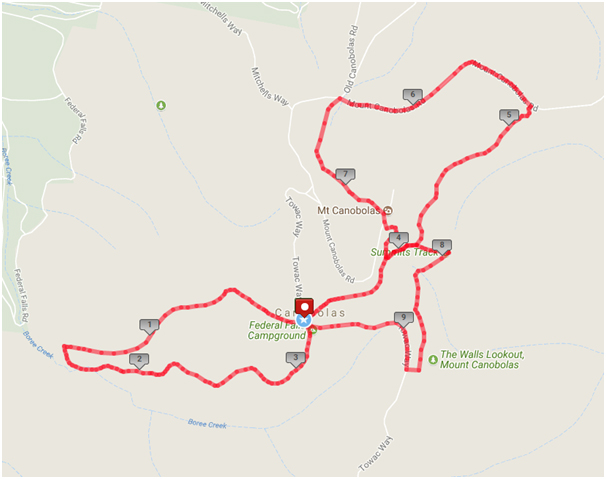
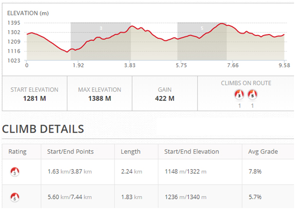
- Course Map & Elevations (9.58km & 422m elevation):
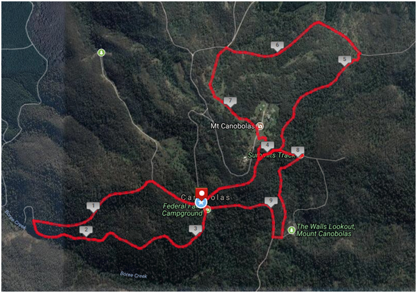
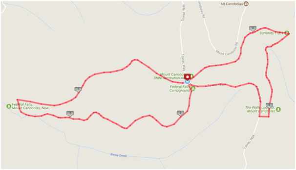
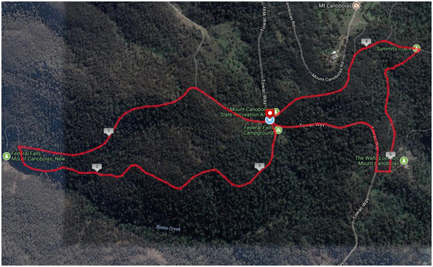
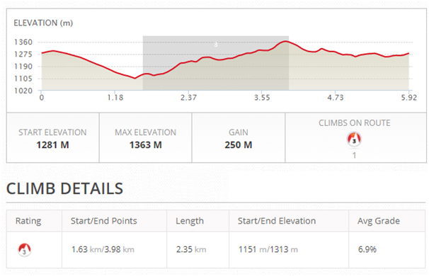
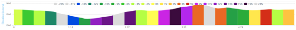
- Course Map & Elevations (5.92km & 250m elevation)


Starting at the Federal Falls Carpark, head west (on the northern option) and complete the Federal Falls loop coming back on the southern option. Head east on the Snowgum Track. Veer right onto the Summits Track and then turn left and head north on the Spring Glade Track. Turn left onto Mount Canobolas Road. Once you are at the intersection of Old Canobolas Road, turn right and head up the trail to the south towards the summit of Mount Canobolas. Once at the summit, head down the Summits Track. Turn right onto the Nature Track and head south. At the end of the track turn right and turn right again onto Towac Way. Continue west back to the finish line at the Federal Falls carpark.


Starting at the Federal Falls Carpark, head west (on the northern option) and complete the Federal Falls loop coming back on the southern option. Head east on the Snowgum Track. Veer right onto the Summits Track and then turn right onto the Nature Track and head south. At the end of the track turn right and turn right again onto Towac Way. Continue west back to the finish line at the Federal Falls carpark.